![]()
Some examples using Ocelet
Coastal dynamics of mangrove ecosystems
The evolution of the coastline of French Guiana between Cayenne and Kourou between 1986 and 2006 is modelled as resulting from the combined effect of waves, currents and the displacement of a mudbank 20 km long and 5 km wide along the coast. The 'chenier' (immobile, in green) and the initial status of the 'coastline' (mobile, in yellow) are read from a shapefile. A forcing relation between 'ocean' on 'coastline' describes empirically the deformation of 'coastline' as a function of daily waves, prevailing currents, and also the position of the mudbank which acts as a protection against the waves.
Team: AMAP (C Proisy, E Blanchard) and TETIS (D Lo Seen, P Degenne)

See model outputs in Google Earth (plugin required).
Colonisation by an introduced plant species
This modelling case is completely fictitious where a new plant species is introduced in an empty space and therefore faces no competition apart from itself. Simples rules are used for simulating plant growth through different phenological phases. In its adult phase, a plant can produce seeds that are spread in its close environment. Some of the seeds germinate, grow and reach the adult phase before producing their own seeds. A local constraint hinders germination and growth when plant density is too high.
Team: TETIS (D Lo Seen, P Degenne)
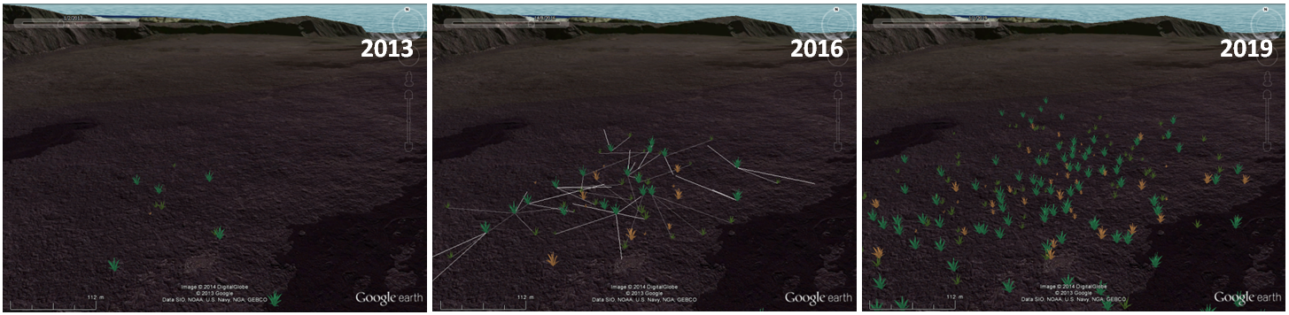
Here is an output (134 kb) of the model to be displayed in Google Earth. The complete model is available here (188 kb).
Land cover change in an agricultural landscape
A frequent use of spatial dynamics models is to study the drivers of land cover and land use change. In the present example, we model agricultural plots and the farms to which they belong. Farmers manage crop rotations and fallow in their plots according to individual “strategies” towards fewer or more crop species. The time step is the year. Model parameters can be changed to simulate different scenarios of farm diversification or specialisation, following concerted or independent management choices.
Team: TETIS (D Lo Seen, P Degenne)
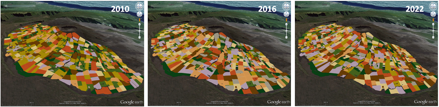
Here is an output (3.3 Mb) of the model to be displayed in Google Earth. The complete model is available here (3.8 Mb).
Pest spreading in an agricultural landscape
In the previous land cover change model, we have added the possibility of some plots being attacked by insect pests that can contaminate neighbouring plots through proximity. Some land cover types can be used by the insects as favourable environments for reproduction or food, whereas others are unfavourable environments to be avoided. The time step is the week. The model is initialized with pests present in some plots with a land cover favourable for pest reproduction. Neighbouring plots containing food for the pests are contaminated and the pests are gradually dispersed into the landscape. Different land cover change scenarios can thus be tested for their capacity to resist pest spreading.
Team: TETIS (P Degenne, D Lo Seen)
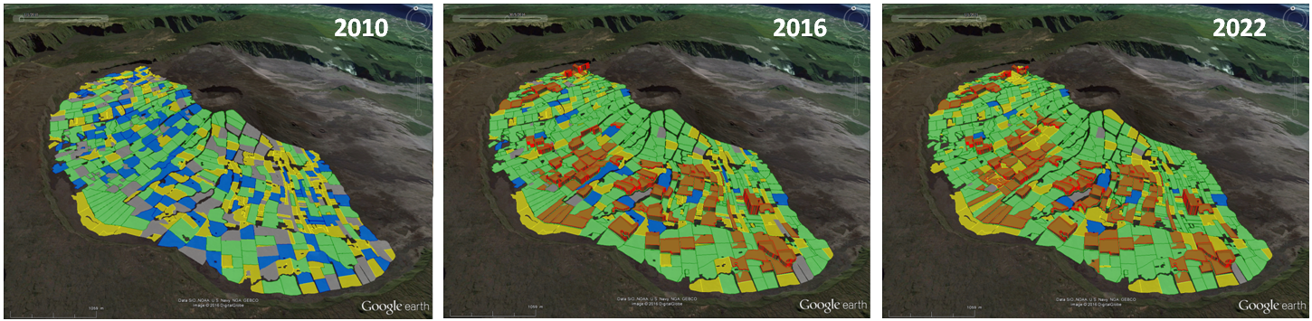
Here is an output (10.1 Mb) of the model to be displayed in Google Earth. The complete model is available here (13.8 Mb).